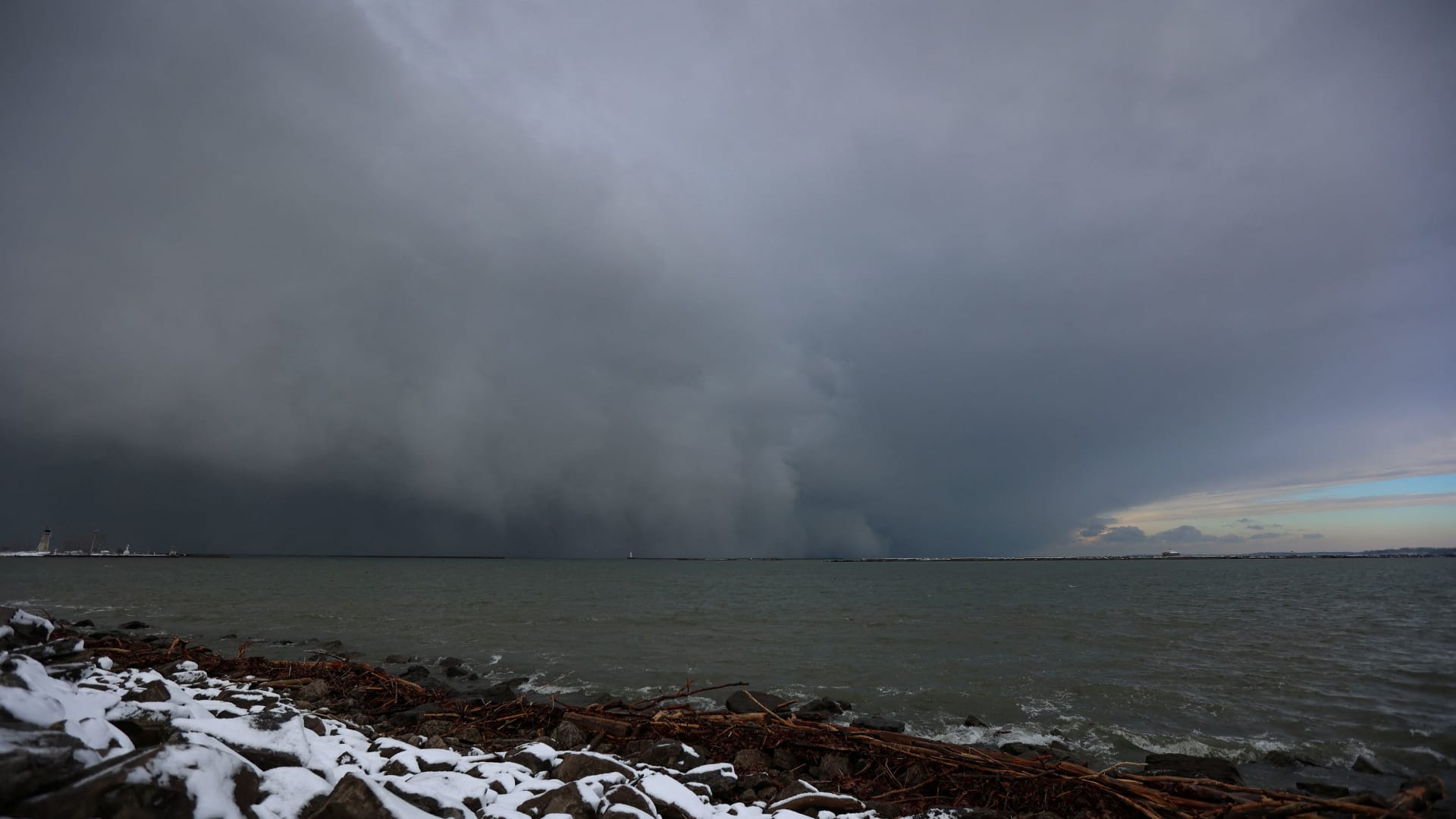
The first big snowfall of the season is blanketing towns along Lake Erie in upstate New York and northwestern Pennsylvania in the middle of the hectic holiday travel and shopping weekend, while numbing cold and heavy snow could persist into next week and cause hazards in the Great Lakes, Plains and Midwest regions.
The heavy snow has led to a state of emergency declaration in parts of New York and a disaster declaration in Pennsylvania, with officials warning of dangerous conditions for Thanksgiving travelers trying to return home.
“Travel will be extremely difficult and hazardous this weekend, especially in areas where multiple feet of snow may accumulate very quickly,” the National Weather Service said Saturday.
Part of I-90 in Pennsylvania was closed Saturday, and as were westbound lanes of the New York Thruway heading toward Pennsylvania. Nearly two feet (61 centimeters) of snow has already fallen in parts of New York, Ohio and Michigan and some 29 inches (73 centimeters) of snow was recorded in Pennsylvania’s northwestern tip.
The roads in parts of northwestern Pennsylvania became so impassable early Saturday that scores of people took refuge overnight in the lobby and hallways of a fully booked Holiday Inn hotel near I-90. Jeremiah Weatherley, a staffer at the hotel, said dozens of people rolled in as the snow piled up, with workers opening the hotel’s conference room and giving people blankets so they could sleep on the floors.
“It was hard to manage but we had no choice,” he said. “They just showed up and we don’t want to turn people away.”
Weatherley said he was making people bagels and handing out juice and cereal on Saturday morning, as the group pitched in to help one another dig out their cars from the heavy snow.
“Everyone helped each other,” he said. “It was pretty cool.”
This week’s blast of frigid Arctic air also brought bitterly cold temperatures of 10 to 20 degrees Fahrenheit below average to the Northern Plains, the weather service said. That prompted cold-weather advisories over parts of North Dakota.
Cold air was expected to move over the eastern third of the U.S. by Monday, the weather service said, with temperatures about 10 degrees below average.
Parts of Michigan were battered by heavy lake-effect snow. Bands that have been rolling off Lake Superior for the past three days had buried parts of Michigan’s Upper Peninsula under two feet of snow or more just before noon Saturday, said Lily Chapman, a meteorologist with the National Weather Service’s Marquette, Michigan, office.
She said 27 inches was on the ground just northeast of Ironwood, in the UP’s western reaches adjacent the Wisconsin state line. Another two feet of snow had fallen in Munising, Michigan, in the UP’s eastern region.
She said the narrow bands of lake effect snow that snake their way off of the lake, driven by cold northwest winds, can produce wide ranges of snowfall amounts over small geographic areas.
“In some spots in the same town you can see a foot of snow and then just a few miles away you could have over two feet,” she said.
Chapman said the continued lake effect snow showers could add more than a foot of snow over Michigan’s eastern UP through Monday morning, with six to 10 inches or higher in the western UP. Temperatures were in the teens and 20s Fahrenheit in western UP and the upper 20s in the eastern UP on Saturday.
In the Deep South, there’s no snow is forecast — but temperatures have dipped below freezing.
“This is the start of our winter season,” said Sam Marlow, a meteorologist with the National Weather Service in Atlanta. “This morning, we got below freezing for almost all of north and central Georgia.”
And in the mountains of northern Georgia, the temperature dipped to about 22 degrees Fahrenheit.
“We are looking at the temps warming up during the day, getting up to about 50 degrees,” Marlow said.
By Tuesday morning, the low temperature could fall into the teens in isolated parts of Georgia, he said.
In Pennsylvania, Gov. Josh Shapiro signed a proclamation of disaster emergency. Shapiro said parts of Erie County in northwestern Pennsylvania had already received nearly three feet of snow with more expected through Monday night. He said state emergency, police and transportation teams had been on the ground overnight to help to any stranded drivers “and make sure emergency responders can get to folks who need them.”
Pennsylvania State Police responded to nearly 200 incidents during the 24-hour period from 6 a.m. Friday to 6 a.m. Saturday, officials said.
As flakes began flying Friday, New York state forecasters warned 4 to 6 feet of blowing and drifting snow could fall in Watertown and other areas east of Lake Ontario through Monday.
After an unusually mild fall, as much as 2 to 3 feet of snow were possible along Lake Erie and south of Buffalo from lake-effect bands notorious for pummeling the region with snowfall rates of 2 to 4 inches per hour. Lake-effect snow happens when warm moist air rising from a body of water mixes with cold dry air overhead.
“The lake is 50 degrees. We’re about six degrees above where we should be this time of year, that’s why we’re seeing these heavy lake-effect events,” Erie County Public Works Commissioner William Geary said. “The outlook for the next two weeks into December, we’ll probably see some more.”
New York Gov. Kathy Hochul has declared a disaster emergency for affected counties. Rapidly deteriorating conditions Friday caused closures along Interstate 90, and tandem and commercial vehicles were banned from Interstate 86 in western New York and much of U.S. Route 219 beginning Friday afternoon.
“As New Yorkers face this lake effect snowstorm, I urge New Yorkers in impacted regions to remain vigilant and avoid unnecessary travel,” Hochul said in a statement Saturday morning, warning residents that more snow is on the way.
